Supported by KUWI scholarships and KI-WATER, the BOKU students are working alongside Ugandan MSc students to conduct river discharge measurements across key catchments in the region. The joint campaign forms part of the KI-WATER project, which aims to strengthen regional capacity in Integrated Water Resources Management (IWRM). The research addresses a critical knowledge gap in the Kigezi Highlands: the lack of comprehensive hydrological baseline data needed for sustainable water resource planning and management.
The field investigations focus on two contrasting catchments representing different hydrological and land-use conditions. The Maziba Catchment (722 km²) is relatively urbanized and includes Kabale Municipality, where anthropogenic pressures such as inadequate wastewater treatment, informal water abstraction, and wetland degradation affect the watershed. In contrast, the Ruhezamyenda Catchment (720 km²) represents a predominantly rural system dominated by agricultural land use. This catchment also contains important freshwater lakes, including Bunyonyi, Mulehe, and Mutanda, which influence regional hydrological processes. The monitoring campaign is strategically scheduled to capture dry-season conditions (February) and the onset of the wet season (March).
Following this initial campaign, Kabale University KI-WATER students will continue monitoring water quantity and quality at selected sites for at least 12 months to capture seasonal variability. This extended monitoring will provide insights into how hydrological processes and water quality respond to changing climatic conditions and catchment characteristics.
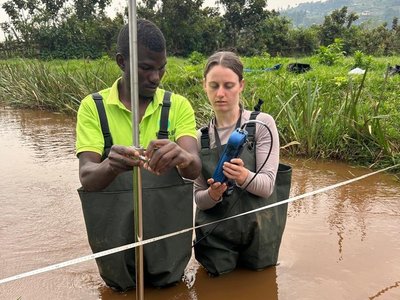
Multiple field techniques are used to measure discharge depending on the characteristics of each water body. These include the salt dilution method for small streams, current meter measurements for larger rivers, and the floating method where other approaches are not feasible. Measurement sites were initially identified through GIS-based desktop analysis and subsequently verified in the field for accessibility and suitability.
Following data collection, the data will undergo spatial and statistical analysis. BOKU researchers will delineate stream networks and catchment boundaries and interpolate discharge measurements along river systems. Results will be analysed as absolute discharge values to enable comparisons across sub-catchments. These analyses will be complemented by hydrometeorological data from the recently installed weather station at Kabale University. Integrating field and meteorological data will help researchers understand how climate variability and land-use patterns influence hydrological dynamics in the Kigezi Highlands.
Beyond generating scientific data, the campaign provides valuable hands-on training in hydrometric measurement techniques and field-based environmental research. Students gain practical experience using modern monitoring equipment and applying integrated approaches to water resource assessment. Working together in the field also fosters intercultural exchange and builds professional networks between Austrian and Ugandan students. The collaboration further strengthens institutional ties between BOKU University and KAB, laying the groundwork for future joint research initiatives and academic partnerships.
The hydrological baseline data generated through this research will provide an important foundation for evidence-based water resource management in the Kigezi Highlands. The findings will support teaching and research at KAB and will be shared with regional stakeholders and decision-makers to inform sustainable water management strategies.
Ultimately, the field campaign contributes directly to the broader objectives of the KI-WATER project, which seeks to build regional capacity in Integrated Water Resources Management, improve understanding of the links between environmental integrity and water resources, and support sustainable development in the Kigezi Highlands.